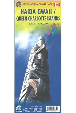
ITM har kart over hele verden og de spesialiserer seg på land litt utenfor allfarvei. Beliggenheten til landets nasjonalparker, historiske monumenter, de viktigste veiene o.L. Finner du inkludert i kartene. Samtlige landkart har ofte et bykart over hovedstaden.
Fra ITM: 7th edition 2017. Times change, and a consensus has grown into a realization that the traditional indigenous name for the islands off BC's shore should be recognized. At the same time, the official name still recognizes the historical relationship of Queen Charlotte and the early days of British trading. We have added a new map of BC's coastline to the reverse side, covering from the US border north to Prince Rupert. As well, both sides have their own Top Attractions lists to focus attention on major sites, such as Ninstints at the southern tip of HG. As in the past, this edition is printed on tear-resistant waterproof paper. Coast in the scale 1:900.000 with inset maps of Vancouver & Victoria. Haida Gwaii in the scale 1:280.000.
Publisert år: 2017
Innbinding: falset
Material: Plastpapir
Målestokk: 1:280000


